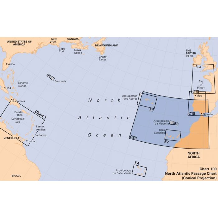
Imray chart C20 Strait of Gibraltar to Arquipelago dos Açores and Islas Canaries
British Isles and Northwest Europe | C Series
Editie 2021, herdruk en bijgewerkt tot februari 2023
Correcties beschikbaar op de site van Imray ...
Passage Chart:
A passage chart designed for planning and navigating across the North Atlantic between Gibraltar, the Azores and the Canary Islands.
Based on official Hydrographic Office data with additional information from across Imray’s network, tailored to appropriate scales and level of data for leisure sailors.
Imray’s award-winning cartography includes a familiar, logical colour scheme, coloured light sectors and fine overprinted latitude and longitude grids to make plotting easier.
On this edition the magnetic variation curves have been updated with the latest data. There has been general updating throughout.
Imray C Series charts cover sailing areas in northwestern Europe. These series form the most comprehensive range of yachtsmen’s charts available. Suitable for passage planning and larger scale charts for navigating the coastal waters even close to shore.
About Imray Charts:
Imray charts set the standards for the leisure sector with award-winning cartography which features a distinctive colour scheme, coloured light sectors and fine overprinted latitude and longitude grids to make plotting easier. Imray Charts are based on up-to-date official surveys. These charts receive continual attention and amendment by skilled staff who monitor corrections to ensure that they are always as correct as possible when despatched.
Charts are generally reprinted annually, at which time they are corrected to date. Once a new edition has been published the old edition cannot be corrected and is unsafe for navigation and should be replaced.
Imray is based in St. Ives, England, UK.
Nearly all Imray charts are printed on Pretex, a partially synthetic paper, which folds well and is durable in damp conditions. It may be drawn on in both soft pencil and ballpoint pen. Imray charts are normally published to an approximately A4 fold format and supplied in robust PVC wallets.
All Imray charts are based on WGS 84 datum. Most charts are metric. Every chart includes details of the datum and projection on which it was based, to allow it to be used safely with satellite navigation systems. Details of the latest printing and edition dates of charts are available.
Nog niet alle beschrijvingen zijn vertaald.
Daarom staat op deze pagina de beschrijving in het Engels.