Imray chart Chart 100 North Atlantic Ocean Passage Chart
North Atlantic Ocean. Edition date: 2018. Printed and corrected to: July 2024.
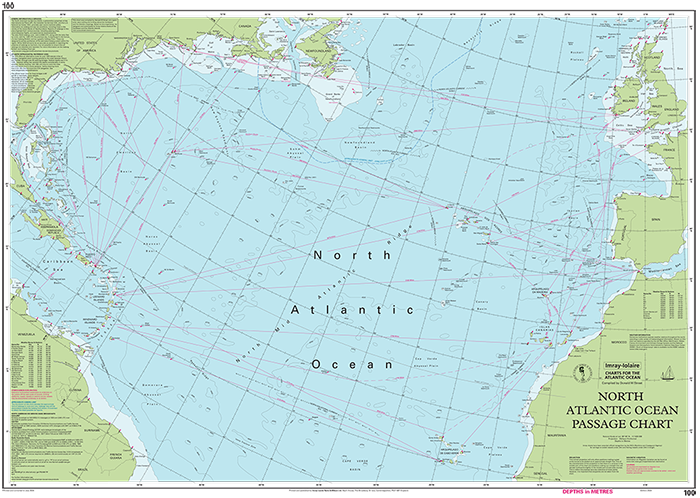
At a scale of schaal: 1 : 7.620.000 this chart covers the North Atlantic from Brazil to Newfoundland and Gibraltar to the Caribbean. It has been constructed on a conical projection that means that Great Circle tracks can be plotted as straight lines rather than curves.
The chart shows the main trend of contours, limits of ice, magnetic variations and keys routes as identified by DM Street. On the reverse are notes on the routes and small wind rose charts, with accompanying charts showing excessive wave heights and storm frequencies for the months that yachts cross the Atlantic: April to July and September to December.
Chart 100 is an important companion for Atlantic yachtsmen on passage and an excellent source of planning information.
De kaarten van Imray worden gedrukt op 'Pretex', een speciaal soort papier dat duurzaam, waterbestendig en gemakkelijk op te vouwen is. De kaarten zijn prima te beschrijven met potlood en bij te werken met pen of stiften.
Nog niet alle beschrijvingen zijn compleet vertaald.
Daarom staat op deze pagina ook nog een deel van de originele beschrijving in het Engels.